Route name: East ridge (Higashi-one 東尾根)
Mountain: Tanigawadake (谷川岳)
Length: 2 rock pitches + hundreds of metres of simul-climbing
Time: 6-7 hours to Okinomimi (オキノ耳) summit
Grade: III+ for hardest rock pitch / Overall grade 1 alpine route
Getting there:
From Tokyo take the Takasaki Line to Takasaki (高崎, about 1.5 hrs). Change for the Joetsu Line to Minakami (水上, about 45 mins), then take a local for 2 stops to Doai (土合). From the underground platform at Doai station, climb a 489-step staircase form hell to reach ground level. Exit the station and join the main road, turning right and walking under a railway bridge. Follow this road for about 20 minutes up to the Visitors Centre.
Description:
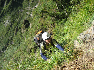
This route is more commonly climbed as a winter alpine route, but in summer it provides a superb adventure route. The terrain is never particularly technically difficult, but is of the typical loose rock and steep unprotectable grass that one often encounters in Japan. It requires a cool head in places, and lots of simul-climbing to complete the route in guidebook time.
After a 30-minute walk up the road from the Visitors Centre you will come to the entrance to Machiga-sawa (マチガ沢), marked by a rock with numerous single-pitch routes and a plaque of a naked lady. At the entrance to the sawa there is a path heading up the left slope into the trees. Follow this up for about an hour. Eventually you come to a short steep trail that breaks off down the slope into the sawa, just below the level of the large boulder that is marked on the topos.
Descent slope into sawa:

The descent is easy, so head down, and you will have saved yourself an hour or two of boulder hopping up Machiga-sawa.
Looking up Machiga-sawa:

Continue up the sawa a little way and over the large boulder, and you will come to a fork. The approach gully to the Shinsen col (シンセンのコル) is on your right at this point. Head up the steep and narrow Shinsen-sawa, until it opens up about 20 minutes further up.
In Shinsen-sawa:

From here you must head up the steep grass, bearing right. There is an improbable trail to follow.
Heading up to Shinsen col:
Eventually you'll reach a bolted belay. This is the point at which to get the rope out, and 2 easy pitches (bolted belays) will see you on the Shinsen col. This is the start of the East ridge. In winter the col is accessed from the Ichinokura-sawa side, but in summer that route is much harder.
From the Shinsen col you can begin to simul-climb. A couple of rope lengths brings you to the first pitch, a chimney protected by pitons, about 15m in height. It is exposed but easy. From the top, continue along and up the ridgeline. After several hours you come to the section where the ridge flattens, staying roughly horizontal for about 100m. This is a good lunch spot.
At the end of this section lies the second rock step. It can be avoided on the right up steep and perilous grass, but a slip here would have serious consequences. The rock itself initially looks improbable at grade III+, but on closer inspection it is very juggy and does not last long. The pitch is about 25m in length, with a good crack in a rock at the top for a belay of 2 large-sized nuts. A further rope length takes you over the top of the rock step, down a short delicate traverse that requires care, back onto the grass and up to a grassy ledge with a bomber piton in a piece of rock to belay from.
From this point you just need to simul-climb up the remaining 100m, follow a scary traverse just under the summit ridge for about 30m, and then the final push up and over onto the ridge. The summit of Okinomimi lies about 20m away in the direction of Tomanomimi (トマの耳).
On the summit ridgeline:
Summit of Okinomimi (1977m):
Looking back down the East Ridge:
Summit of Tomanomimi (1963m):
The upper section of the East ridge:
The approach to the Shinsen col (centre of picture):
The lower East ridge:
From the summit, descend the normal tourist trail to the hut below Tomanomimi, from where you can either head down to Tenjindaira (天神平) and the ropeway, or you can descend the Nishikuro-one (西黒尾根) ridge trail. This latter is recommended, as it provides an aesthetic end to the day, with the ascent and descent ridges neatly flanking Machiga-sawa.
The Nishikuro-one ridgeline:


No comments:
Post a Comment