Route Name: Uradoushin runze (裏同心ルンゼ)
Mountain: Yokodake (横岳 Yatsugatake massif)
Length: 300m
Time: 3 hours to top of descent ridge (Daidoushin-ryo)
Difficulty: Grade 2- winter alpine route / WI3/4 crux
Getting there:
Take a Super Azusa express train from Shinjuku to Chino (approx. 3 hours). Outside the JR station at Chino take a bus to Minotoguchi (approx. 1 hour). This is the gateway to the Akadake-kōsen side of Yatsugatake. From the carpark start hiking up the trail that is signposted to Akadake (赤岳). The walk-in takes around 3 hours by map time. It is split into 3 stages. The first hour brings you past a series of buildings and on a little further to a hut that makes a good resting point for 5 minutes. The next hour follows the road until it finishes at a bridge across the sawa. From the other side the path narrows and meanders alongside the sawa for another hour or so until you reach the hut at Akadake-kōsen. This hut serves as basecamp for all the routes in the area.
Topo:

Description:
As you exit the Akadake-kōsen hut by the front door you have 3 paths to choose from. Left takes you to the descent trail back to Minotoguchi; right takes you towards the Nakayama-One (中山尾根) and beyond to Akadake; straight on provides access to the ice routes (Daidoushin runze, Uradoushin runze, Jougosawa) on the left-hand side of the face below the summit of Yokodake (横岳). For this route you need the latter path.
Follow the trail for about 20 minutes through the forest and you will come to a signpost pointing right into the bottom of the Daidoushin runze. Continue along the trail for another 5 minutes and you will reach another junction at the bottom of the Uradoushin runze (runze is Japanese for ‘gully’). If you continue straight along the trail you will soon reach the first waterfall of Jougosawa (ジヨウゴ沢), but for today’s route turn right into the wide lower section of the Uradoushin.

Looking back at the lower slopes:

Hike up the runze, and after about 10-15 minutes the walls will narrow and you will reach the first waterfall (F1). Depending on conditions that year, it could be thin, fat or even almost buried under the snow. F1 is up to 15m, although this year when we climbed it (Jan 2011) the bottom third and the sides were banked out.
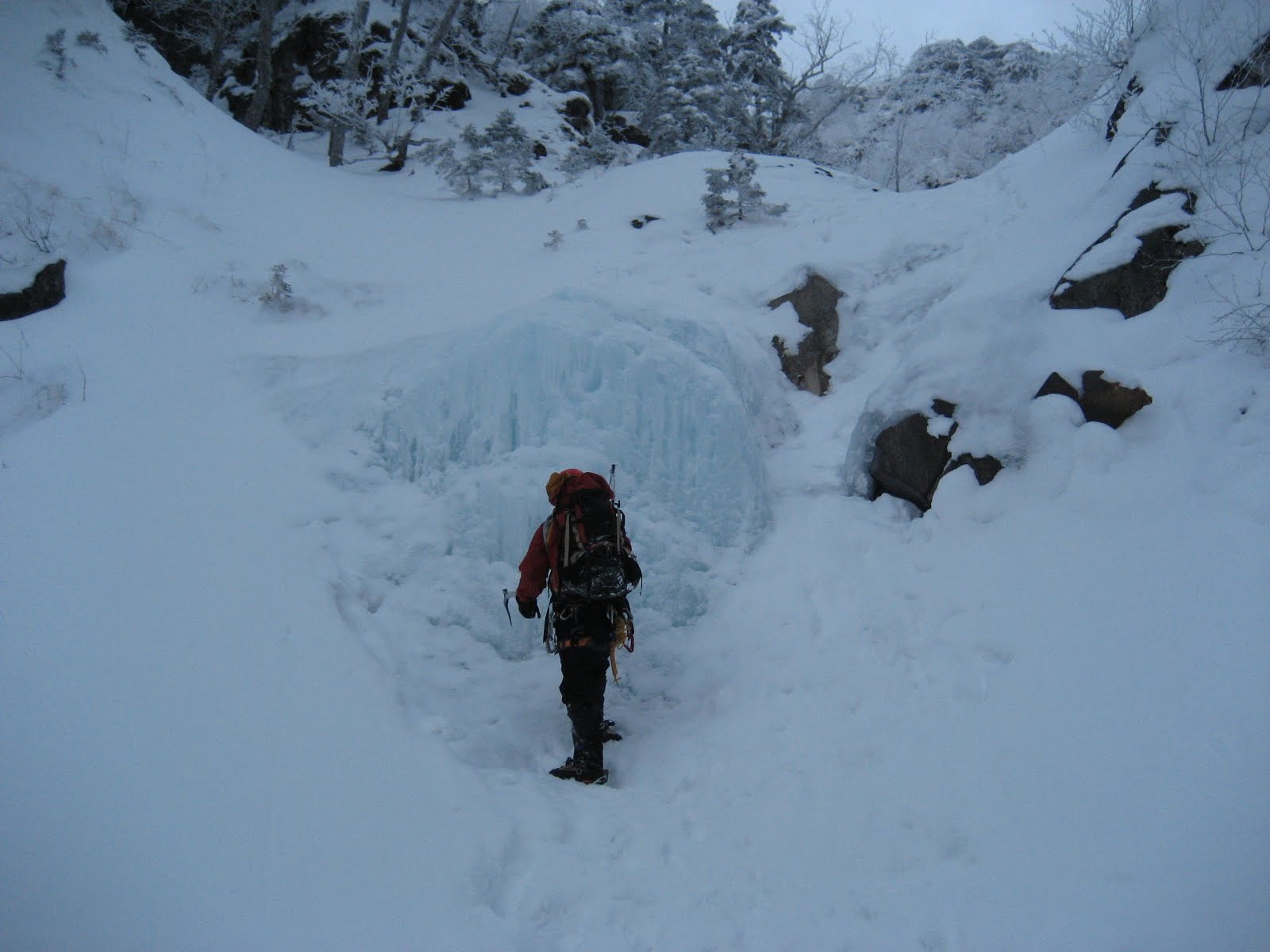

After F1 continue up the snow slope past another sawa on your left, to reach F2 (40m), a longer series of steps. Pass another sawa on your left and you will reach F3 (8m). A longer snow slope brings you to F4 (20m), and above this you will see the crux pitch of F5. F5 is only 10m, but unlike the previous falls, it is vertical in its top half. A fairly leisurely pace should see you at F5 within 2-2.5 hours.

The top of F4:

Looking up towards a banked out F5:

Approaching F5:


Getting over the lip of F5:

Once you have passed F5, you will see that the gully ends in a vertical wall which the ‘Challenge! Alpine Climbing’ guidebook describes as F6. This probably forms only rarely, if ever, and the natural way to finish the route is to traverse right, up the steep slope of frozen turf and rock that skirts under the Daidoushin rock pinnacle (大同心). From here the rock wall of the Daidoushin looks formidable.
Daidoushin:

F6 (or not...):

The traverse on frozen turf:

Skirting the Daidoushin:


After a traverse of about 100m you will reach a saddle in the Daidoushin-ryo (大同心稜). Looking down from here you have the Uradoushin on your right and the Daidoushin runze on your left. Up above on the other side of Daidoushin runze you will see the Shodoushin rock pinnacle (小同心), with the Shodoushin Crack cleaving it down the front.
At the top of the Daidoushin-ryo descent ridge:

Cloud streaming off Amidadake:

Walk down this ridge for about 45 minutes (be careful with your footing in places) and you will enter the bottom of the Daidoushin runze, from where a further 5-minute walk will bring you back to the main trail.

Depending on time and energy levels, if you want to get something else done, you could take a walk into Jougosawa for some more water ice climbing, or head back to the hut and climb on the ‘ice candy’ artificial ice wall.
The 'ice candy' wall:


Overall:
The Uradoushin is a fun and straight-forward ice route, which can be combined with Jougosawa or the ‘ice candy’ to provide a fantastic day of ice climbing, and can be done relatively safely even in strong wind or less-than-perfect weather due to the protection offered by the side walls of the gully.
Many thanks for recalling this fun winter outing to memory. One might add that the gully isn't the place to be after heavy snowfall or while the warm "haru ichiban" wind is blowing. I don't remember F5 and F6, though - maybe they were totally snowed up when we passed by....
ReplyDeleteHi Project Hyakumeizan
ReplyDeleteThanks for the valuable additions about likely avalanche conditions. The wall that the guidebook describes as F6 is level with the bottom of the Daidoushin, and pretty high. As well as being vertical, a good look at it didn't offer up many options for protection, unfortunately. It goes without saying that it will have been climbed many times by Japanese climbers far tougher than me :-) (of whom I'm also sure there are many!!) but my partner and I didn't fancy it on the day, so opted for the normal traverse out to the top of Daidoushinryo. A pity really, because above F6 the terrain looked steepish but reasonably straightforward, and it would have provided a much more elegant finish to the route, topping out on the summit ridge.
Uradoushin is definitely a god day out though :-)
Tony