
Most people who climb Mt kaikoma (甲斐駒ケ岳 2967m) will have gazed across
at the jagged sawtooth ridgeline that stretches northwest over to the summit of
Mt Nokogiri (鋸岳 2685m). The majority will have taken one look at that
dotted line on the hiking map, with its danger markings and warning signs, and
dismissed it as one for the foolhardy.
A good decision for many; the sawtooth ridgeline is not for the faint of
heart. But a traverse of this
classic South Alps itinerary makes for an absolutely unforgettable day,
magnificently blurring the boundaries between trail runner and mountaineer.
Getting there:
This itinerary requires
commitment, as there is no quick and easy way to get to the start from
Tokyo. Whether you come by car, bus
or train, you’ll need to get round the northern end of the South Alps to Ina
City, and then make the short hop (local bus or taxi, if using public
transport) up to Todai (戸台).

The carpark at Todai marks
both the start of this route and the gateway to the Todai River. Before the Minami Alps Rindou (South
Alps through-road) was built, this was the standard way to access the northern
end of the South Alps, but now it is rapidly falling into disuse. As the empty
shells of collapsing tea houses and mountain huts along the banks of the Todai
will attest, the bus to Kitazawa Pass
(北沢峠) has
superseded this route. But make no
mistake; this is by far the more impressive route, both in terms of ambience
and scenery.
The route (GPS track courtesy of Hanameizan):

Strategies:
1. In one day
This will require a trail
runner’s speed and fitness. Aim to
arrive at the Todai car park late evening and camp for a few hours. An alpine start (around 2AM) will see
you a good way up the scree chute to the ridgeline by dawn, leaving plenty of
time to make the traverse and get down to Kitazawa Pass for a microbus back to
the red iron bridge (Todai O-hashi 戸台大橋) about a kilometer short of the
Todai car park.
2. In two days
A more leisurely morning
start from Todai, and a comfortable hiking pace, will probably give you enough
time to traverse the sawtooth ridge and arrive at the Rokugome hut (六合目小屋), below the summit of Kaikoma. If so, you can spend the night here. If
not, bivvy anywhere you like on the ridge. You can traverse the summit of
Kaikoma the following morning, descending to the Kitazawa Pass for a bus out or
back to your car.
Description:
The first hour or two is a
relatively gentle hike up the Todai River
(戸台川). During the day it is easy to spot the
trail winding its way up the wide riverbed, and you will be treated to
fantastic views of rock walls on either side in places.
At night it is a different
story, and the route finding becomes far trickier by headtorch. Cairns marking
the way blend into the rest of the rocks, and you should expect numerous false
starts and back-tracking to find the correct route.


You will have to cross the
river here, so take care on the slippery rocks. Once safely arrived at the other side of the river, head
towards a stone cairn and from there, follow the trail upwards.

The trail climbs steeply up
through forest, with pink tape markers attached to tree branches from time to
time. After some time, you’ll hit
treeline and things will open out as you find yourself at the bottom of a
steepening gulley with an enormous cliff on your right. Skirt this cliff as quickly as you can,
with helmet on, and beware of rockfall from above.

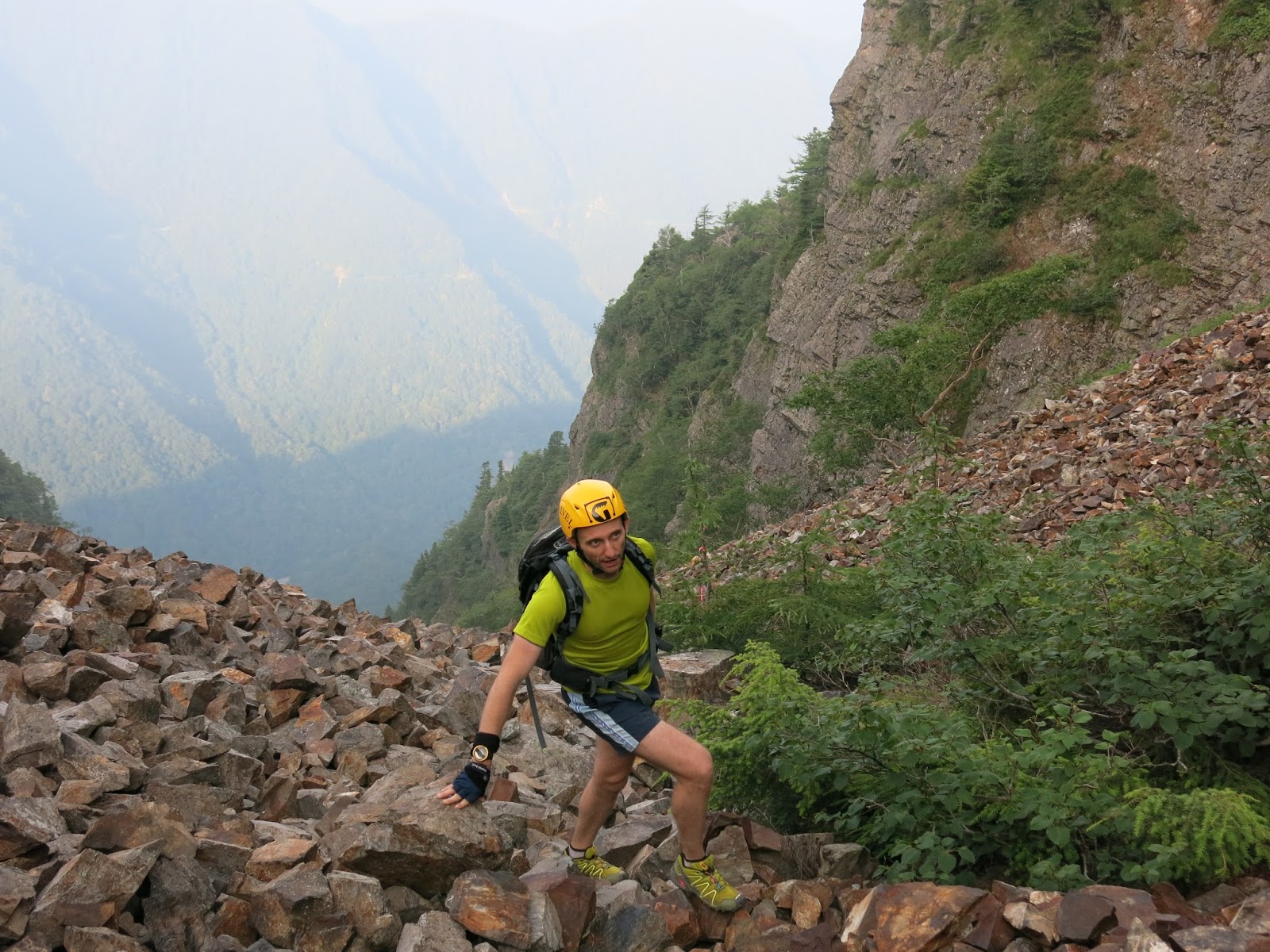
From here to the top you are
in a steep boulder chute. It is
quite simply amazing… stones piled up on stones, seemingly at the angle of
repose. It looks bad, but as long
as you move confidently and carefully, it’s not as bad as your imagination will
be telling you!

After climbing this boulder
chute for what seems like hours, you will eventually find yourself deposited on
the col. Take a brief rest before making the short hop up to the ‘nihyakumeizan’ summit of Mt Nokogiri.
The views from here are
outstanding, in all directions.

Prepare yourself now for the sawtooth traverse. Heading southeast towards Mt Kaikoma you will spend the next few hours picking your way carefully up, down and along a narrow rocky ridgeline, with tremendous exposure in places.

The most notable places to look out for are:
* the first gap – a vertical in-situ chain takes you down about 20m
into the gap, then a scramble up a 40m chain on the other side brings you back
onto the crest of the ridge. From
there you’ll need to climb down onto an exposed ledge, and traverse across
above the void for about 10m before you get back onto a comfortable hiking
trail again. There are always
holds where you need them, so go carefully and enjoy the exposure!


* the ‘Shika-no-mado’ hole –
This ‘eye of the needle’ hole is visible from down below on the Minami Alps
Rindou, and is a very famous spot on the ridge, so be sure to snap your photo
in there!

* the second gap – much deeper and larger than the first, this begins
with a long chain from inside the ‘Shika-no-mado’, which puts you on a thin
trail. Traverse this ledge along
the grassy and rocky slope to climber’s right, then down into the gap. Keep an eye out for where the trail
goes, as it’s easy to get off route here… We did, and ended up traversing the
cliff face about 30m above the gap, where a fall would have had serious
consequences. The scree in this
gap is extremely loose, so be careful not to start a slide. From the other side of the gap, a wet
greasy trail climbs the steep slope back up to the ridgeline.


View to Mt Kitadake, Mt Ainodake and Mt Senjogatake:


Further along the ridge from
here there is one more steep scree slope to descend to another minor gap, and
then you can relax as you’re on decent hiking trail from here onwards.
Looking back at the final scree slope descent (centre):

After several hours of
hiking you will arrive at a junction with a trail coming in from climber’s
left. Keep going ahead towards Kaikoma,
and you will notice how the rock type changes to the white limestone of
Kaikoma.
The Rokugome hut lies about an hour before the summit of Kaikoma, at the
point where the trail begins the climb up the final few hundred metres of
height-gain. A short way up from here you have one final rock step to climb,
with a chain hanging down its full height. It’s very straightforward though, and with a bit of
confidence, the chain is not necessary.


After several minor false
summits along the way, you will eventually hit the 2967m summit of Mt Kaikoma,
without a doubt one of Japan’s finest alpine peaks. Enjoy some of the finest views Japan has to offer!
Looking back to the sawtooth ridge:

Final section to Mt kaikoma summit:

Summit of Mt Kaikoma:


You’ve got a few options for
descent. If you’ve got a car
parked at Todai you’ll need to head down to Kitazawa Pass for a microbus back
to Todai. If using public
transport, you can take the easier option of dropping down to the Pass for a
bus back to civilization, or you can opt for the full descent of the magnificent
Kuroto Ridge (黒戸尾根) back to the valley and the
Chuo Line railway.


Summary:
Hands-down one of the finest
itineraries in Yamanashi.
Enjoyable from start to finish, physically demanding, bringing into play
a broad skill set and definitely requiring a head for heights. What a fantastic thing it is to look up
at Nokogiri and the sawtooth ridgeline from the window of a Chuō Line train and
relive the memories of being up there!
Fantastic, I have been looking at that ridge from Kofu valley since I climbed Kaikoma a couple of years ago.
ReplyDeleteKaikoma is by far my favorite peak in Yamanashi!
We did similar route during the end of 2020. Start was at Kamanashigawa gate (釜無川林道ゲート), spent a night at Yokodake pass (横岳峠) and continued the next day to Mt. Nokogiri. Unfortunately weather during the third day was awful so instead continuing to Kaikomagatake we took an escape route to Todai. Currently there are lots of construction works in Todai region, Todai parking which is present on Yama to Kogen maps in non existent anymore and access trail to the stone chute mentioned in this post is collapsed (we had to rappel down). Also, some parts of the road between Todai bridge and Senryuso are collapsed as well so it makes Senryuso the closest place to park a car from Nagano side.
ReplyDeleteHi Niksa. Thanks for that detail, it's good to know about all this while the repairs are in progress. Last year's typhoons wrought a lot of damage in the area.
ReplyDeleteI'm glad you enjoyed your trip. It's a pity you couldn't do the ridge over to Kaikoma, it looks like a very good (and quite involved) route in winter (see the full description in the Challenge Alpine guidebook). For some reason it only gets a route grade of 1, which seems like a possible sandbag given the remoteness of the start and finish... I'd imagine it would need at least 3 days to complete in proper winter conditions, maybe more at the moment given the access difficulties that you described.
Good luck with your re-match, if you go back again for it :)