Route Name: Southwest
arête (Seinan-kante 西南カンテ)
Mountain: Joyama (城山)
Rock type:
Andesitic tuff
Length: 4 pitches (120m)
Grade: 5.9 crux

For
quality friction slab and face-climbing a couple of hours from Tokyo, you
simply cannot go wrong with Jōyama (城山).
Its expansive South face is home to dozens of top quality multi-pitch routes,
with superb exposure. There is a tree-covered terrace running diagonally
upwards from the top of the face, and it would be possible to ascend this and
reach the summit, but the risk of knocking loose stones onto the climbers below
dictates that climbers rappel the face after their routes.
There
is one beautiful way to the top though. The Southwest arête (historically known amongst Japanese climbers as 西南カンテ, even though 南西カンテ would be the correct modern Japanese) is a striking
natural line up the left edge of the face, with some superb climbing at a very
moderate difficulty for this venue. For anyone looking for exposure and
multi-pitch training, and an introduction to the Jōyama climbing style, this
route is highly recommended.
The
climbing season typically runs from late October through the winter months to
spring. In summer it is far too hot!
Getting
there:
If
travelling from Tokyo on public transport, the simplest way is to take a
shinkansen from Shinagawa (品川) to Mishima (三島),
and then change for a local Izu-Hakone-Sunzu train for Ōhito (大仁).
From there you can either walk to the trailhead in about half an hour, or take
a local taxi.
If
travelling from Tokyo by car, head down the Tōmei Expressway (with a convenient
Starbucks located at the Ashigara service area south of Mt Fuji), transfer onto
the Izu Chuō-do toll road, and stay on as far as Ōhito. Once on local roads in
Ōhito, make your way across the Karino river (狩野川) and
down to a small car park opposite the trailhead.

Description:
From
the trailhead a short walk of about 15 minutes will bring you to a signed
junction in the trail.

Head
right from here up a short scrambly path and you will come out at the bottom of
the South face. It’s a good idea to put your helmet on whilst near the base of
the rock in case of falling stones from above.
Walk
to your left along the bottom of the South face and follow the trail up through
the trees past several zigzags, always keeping the South face in close sight.
In a few minutes the trail heads up to the right. After a short scramble over
stones and tree roots, you will see a small terrace across and slightly down on
the right. This is the bottom of the Southwest arête.
Approximate
pitch descriptions are as follows:
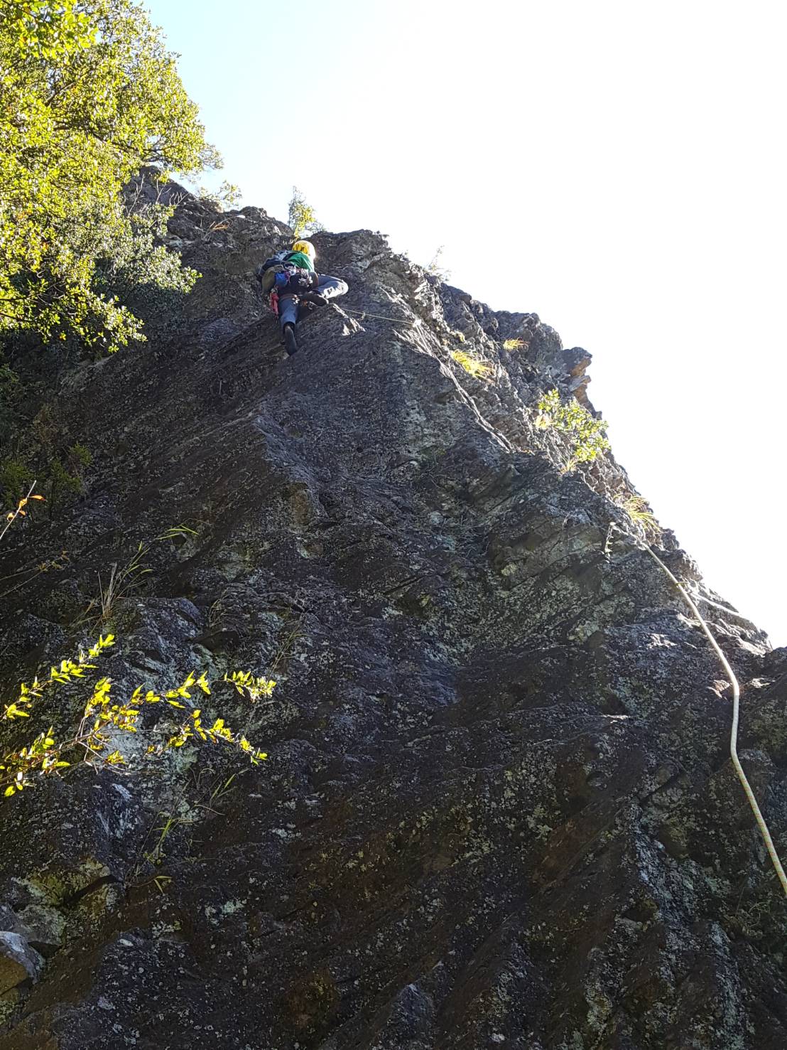
Pitch
1: Climb the first few metres up well-featured rock with excellent friction.
Cross round to the right side of the arête as soon as you can, and then follow
the line of bolts upwards until you reach an in-situ bolt anchor on a small
terrace. (30m 5.8)

Pitch
2: Continue up the arête on excellent rock. The exposure is immediate and very
satisfying. After about 20m you’ll reach a tree-covered area. Continue up easy
ground, past an in-situ rappel anchor on a tree, and over one final slab to
gain the belay platform in an alcove. (35m
5.7)


Pitch
3: A few steep moves will get you out of the belay alcove and to the foot of a
bulge (ring bolt here). If you don’t fancy climbing this directly, it can be
bypassed in two short pitches via a 5.7 bolt-protected traverse out to the
right across a slabby face, and then a scramble up along the base of the
overhanging ‘second rock band’. If you tackle it direct it goes at 5.9, and is
well-protected and engaging. After the initial bulge, continue up through
another steep slabby section, followed by a scramble up loose tree-covered
terrain to the belay anchor on a ledge beneath the final pitch. (35m 5.9)

Pitch
4: After the initial groove, climb out onto the face on climber’s right, then
step awkwardly across to gain the top of a rock jutting out on the left at
two-thirds height. From here, continue up and to the right to belay from any
tree of your choice. (20m 5.8)


From
the top of the route, walk up the trail to your right, and after about 10
minutes you will pop out at a junction on the main Jōyama hiking trail.


The
summit is about 3 minutes up the trail to your right and is a wonderful spot,
sheltered from any westerly winds and with magnificent views of the nearby Karino
river and Ōhito town, and extending all the way to the Tanzawa range (丹沢)
to the northeast and Amagi-san (天城山) to the south.

Descent:
Simply
head back the way you came for a few minutes to the trail junction, and this
time continue down the main hiking trail to the right. After about 15 minutes
or so you will come to another junction on a pass.

Head left and follow the
trail down for about 30-40 minutes and you will arrive back at the trail head
and the road.
Overall:
An
enjoyable climb on excellent rock up some striking features. If not for the
occasional tree-covered sections, it would be first-class. Combining it with a
route on the South face makes for a fantastic day of climbing, with a summit
and great views thrown into the bargain. The in-situ protection is good, so a
rack of 12 quickdraws will be sufficient.
BUY THE BOOK ------- CLIMB THE ROUTES
(Available in print and Kindle e-book from Amazon)

No comments:
Post a Comment